How to get there - Cookham is about 2 miles north of Maidenhead which can be approached from Junction 8/9 of the M4. Take the A308M and at the roundabout take the first exit. Continue over the next roundabout and past the station (bearing left and then right) to the junction with the A4. Turn right and procede to the 3rd roundabout (before Maidenhead Bridge). Turn left into Ray Mead Road and continue for two miles (past Boulter's Lock) to Cookham. (map)
Suggested Launch Site - Launch from the slipway next to the Ferry pub (on right at Cookham Bridge). I usually try to unload the canoe and park the car elsewhere in Cookham to preserve the pubs car parking but often without success. If you are using the pub car park it's only reasonable that you do purchase food or drink at the end of your trip.
General
Description - Set off west (left) under Cookham Bridge. It's 3 1/2 miles to Marlow Lock and a further 2 to Temple Lock. As all Thames Locks are manned and the lock-keepers happy to take canoes through the locks with the larger vessels, there is no need for portage so you can extend or shorten the trip to suit your needs. (route)
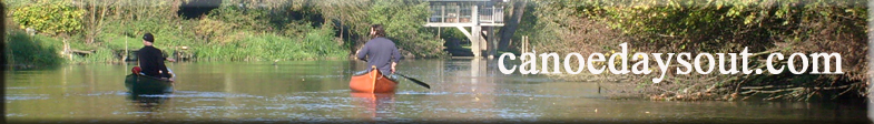
This is a particularly attractive part of the Thames as the Photo Album illustrates.
There is an alternative launch site at the slipway in Marlow (see map) but as there is no suitable parking, I prefer to park in the Pay and Display car park at the north of Marlow Bridge (turn left at the roundabout for the entrance in Pound Lane) and launch over the bank (see map) which will involve a short portage.