How to get there - We entered the River Waveney at Homersfield Bridge, just off the A143 North East of the village of Wortwell. Turn off the A143 signed 'Homersfield' and ignoring the parking area to your right (height restrictor bar at entrance will cause damage to a roof-mounted canoe) drive over the modern concrete road bridge and take the next right. Turn right again and drive past the Black Swan pub and park just before the original Homersfield Bridge - a small metal and concrete footbridge. (map)
Suggested Launch Site - Entry to the river is just below the bridge to the right at the foot of a small sloping grass meadow. There are several easy entry points under the bridge.
General
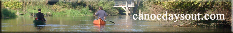
Description - Our first river trip in our new Pelican Explorer was on Saturday 15th September 2007 and it was a glorious day for it - blazing sunshine, no wind, and clear blue sky! We could not have had a better introduction to paddling a river in the UK in a canadian canoe.
We chose the River Waveney for our first river trip for several reasons:
1. It is within 40 minutes of where we live near Stowmarket in Suffolk.
2. It was recently featured on the Anglia TV programme, 'Secret Rivers', which if you haven't seen it, is a great little regional programme shown on TV in the Anglia Region. It features the broadcaster, Paul Heiney, paddling different rivers in East Anglia in a green canadian canoe. This programme showed that it was relatively easy to navigate the Waveney and that is quite a slow flowing river.
3. There are a couple of good websites that provide some excellent information on the Waveney. The Waveney Valley Canoe Club at www.waveneycanoeclub.co.uk gives a complete guide to paddling the upper stretch of the river, (although our trip showed that the information on this site needs to be updated to reflect the river blockages that we encountered). The Outney Meadow Camping and Caravan site at Bungay also has some great links to paddling the Waveney at Bungay (the so-called 'Bungay Loop' around the town.) Their website is at www.outneymeadow.co.uk. The people at the campsite are very friendly and helpful, and they are happy (if you ask first) for you to drop a canoe into or get a canoe out of the river on-site, regardless of whether you are camping there or not. They have a great little landing area, and they will even rent you a canoe if you just want to try it out before you buy your own Canoe.
We were lucky enough to have my wife in attendance with a 'support vehicle' (our family Jeep Grand Cherokee) so we could let the flow take us down river to Bungay, where we were due to be picked up, without having to worry about a return leg paddling against the current. (planned route)
Homersfield is a tiny little Hamlet with the bridge (the UK's first reinforced concrete bridge) and the Black Swan pub being the main features. There are a couple of good entry points for the river immediately below the footbridge. It's a bit shallow under the bridge but after a good shove off into the middle, we were soon paddling in 3 to 4 feet of slow flowing water down river with the current. There were a few low branches to negotiate along the way, but no real problem areas anywhere. I would estimate the deepest parts of the river at around six feet in places, but it is mostly around 2 feet deep or less.
The river meanders gently along for mile after mile in absolutely beautiful countryside and although close to the main road, you cannot hear a thing other than birdsong and the splash of paddle on water. We encountered only two other people, both fishing from canoes. The water is so clean and clear, it's like paddling in gin. This means you get to see a lot of fish.
A few miles on and we found Earsham Sluice. This is a big structure but it is quite easy to negotiate with the purpose built landing area and porterage point on the right-hand bank just before the weir.
Unfortunately, after the sluice, things got very difficult. Just after the footbridge where the Angles Way footpath crosses the river, a fallen tree blocks the river. Fortunately, there are a set of wooden steps cut into the bank just to the left of the fallen tree, and we were able to get the canoe out and carry it over two adjoining fields for some 500 yards and enter into the river again at a cattle drinking area at the end of the second field. This porterage across two big fields was no mean feat for just myself and my 11 year-old son, as you will all know that a Pelican Explorer out of the water is a pretty heavy beast.
(You have to carry your canoe accross the first field past the (scout?) huts on the right, through the metal gate, turning right into the next field. Carry on down to the end of the field to the far left corner where the cattle have broken the bank down to a low area where they can drink from the river. Re-enter the water here.)
However, our thoughts that we had successfully negotiated our biggest obstacle were soon dashed, as not too far further down river there was another larger fallen tree blocking the river just after a narrow channel that cuts off to the left. Again the river was completely blocked and there was no way through for a large open canadian like ours. (Maybe a Kayak could squeeze through?) The banks either side were too steep to get ourselves or the canoe out of the water at that point.
A quick look on the map (OS Explorer 231 Southwold and Bungay) and we could see that the channel going off to the left appeared to cut straight accross country to meet up with the Waveney again West of Bungay. Unfortunately, what appears to be a linked channel on a map is not always what you get in the real world.
About a mile or so further on up this very narrow channel we encountered a road bridge with white steel railings, (Roaring Arch Bridge?), under which is a small weir that is not navigable by canoe due to a large steel girder having been placed across the river a few inches above the water.
We were able to get out of the river and get the canoe up onto the bank to the right of the weir, but re-entry into the channel the other side of the bridge was impossible due to it being straddled either side by private, fenced-off land, and the water in the channel being too shallow at that point anyway.
Porterage further along to the point where the channel rejoins the river proper was out of the question for one adult and an 11 year-old with a large canadian, so at this point we had to admit defeat and call for our 'support vehicle' to come and collect us.
We had originally intended to follow the river around the 'Bungay Loop,' ending our journey at the Outney Meadow Caravan Park, but due to the river being completely blocked by the tree as described above, we were unable to complete our trip this time. We hope to return another time to do 'the Loop' and paddle the section down river further from Bungay.
Although we were not able to complete our trip as planned on this occasion, in reality it may have been a blessing in disguise, as we were both tiring a bit (although Sam would not have admitted it - he was knackered) and it's probably better that we did not do too much on our first trip.
I would recommend the section of the Waveney from Homersfield to Earsham to any other novice canadian paddlers looking to complete a section of about 7 miles or so, as it is very easy going and the water is slow flowing. There is loads of wildlife - we saw an otter, herons, canada geese, egyptian geese, and several kingfishers very close to the canoe, and it is a really quiet and peaceful trip.
The only downside to our day was our first experience of a river capsize. Unfortunately, prior to buying the canoe and planning the trip, I saw nothing on Song of the Paddle or anywhere else to indicate just how easy it is to tip over a canadian canoe. If you haven't had this happen to you, then believe me - it is very easy!
About a mile before the sluice at Earsham, my son and I both ducked to go under a low overhanging branch, but unfortunately we both decided to lean to the right at the same time. Lapse of concentration on my part and the canoe was upside down and we were both in the river in seconds. I was glad we had invested in buoyancy aids, floating rope, and a dry bag for our kit! I am a strong swimmer, but when trying to hang on to an upturned canadian, our floating dry bag, and my son, even I struggled and was very glad of the buoyancy aid. (Lesson there for anyone stubborn, dumb, or foolish enough not to wear a buoyancy aid.)
Whilst it was not easy, we managed to get the water out of the canoe and get back into it within a few minutes. We stopped in shallow water further down river to clean the mud off ourselves and our kit, and to rinse the canoe and our shoes out. As it was a hot sunny day, we were mostly dry again within an hour, so there was no real harm done. And the dry bag really worked. (Only £8.99 from Sue's Canoes in Watton, Norfolk - highly recommended. Nice people, good advice, and reasonable prices too. I'm going back to get a couple more for camping kit.)
However, it made me realise how dangerous canoeing can be. I guess a capsize would not be so easy for me and my son to deal with if it happened in a wider river with deeper water, especially if we had a load of camping kit on board too.
I am seriously considering buying some stabiliser floats or outriggers for our canadian canoe to prevent this happening again when we are paddling in deeper water with extra kit on board. OK, so they look a bit silly, but I would rather not tip me, my son, and all our kit into deep water.
Bottom line is: We still had a fantastic day out in our canoe doing something in the countryside that was great fun and very good exercise for both of us. We have both 'got the bug', so watch this space for further trip reports.