How to get there - Maunsell is 6 miles south of Bridgwater (Junction 24 of the M5) and 5 miles north of Taunton (Junction 25). Take the A38 to Adesborough then turn east and follow the map. The car park is just to the west of the bridge over the canal at Maunsell Lock. (map)
Suggested Launch Site - As we were going south we carried the canoe over the bridge and lauched at the other end of the lock. Maunsell is also the home to a Boat Hire business and the Bridgwater & Taunton Canal Centre.
General
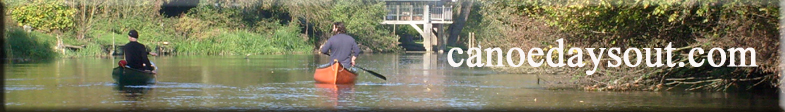
Description - We were using this trip as an introduction to canoeing for some younger members of the family so the trip was deliberately kept short (i.e. 8 miles and two portages).
Higher Lock is encountered after about a third of a mile. From here it is about three and a half miles to Creech St Michael. We stopped here and left the canoe on the small grass area at Creech Bridge. (route) We walked a short distance up into the village to find The Bell pub (not very exiting!) so next time we would walk south to the Riverside Tavern in Bull Street - near the church.
We turned round here but alternatively, you could paddle on for another mile to Bathpool and find the Bathpool Inn (at Bridgwater Road, Bathpool - not canalside). If you get as far as Bathpool you are only 2 miles from the end of the canal at Bridgwater (and even more pubs).
Alternative launching sites are:-
Crossways Swing Bridge, Marsh Lane, Huntworth (see map). Site of the former junction with the River Parrett. There is a car park and picnic area by the bridge.
Mead`s Bridge (see map). A swing bridge, car park and picnic site close to the M5 viaduct north east of Huntworth. The Boat and Anchor pub stands on the canalside.
Bathpool, Dyers Lane, Taunton (see map). A car park and a BW yard situated near to a swing bridge.